MEetups
Flash Foxy MINI FEST • presented by arc’teryx
Red River Gorge, ky • May 15-17, 2026
Schedule is always subject to change. All programs run rain-or-shine. No refunds.
-
If you've registered for the 2025 Flash Foxy Mini Festival you're all set! Meetups are FREE and are included with your festival pass. No registration required, just show up!
-
All location listings are tentative and subject to change day-of. If you have an accessibility concern related to venue locations please email events@flashfoxy.com and we can put you in touch with the meetup organizers!
-
Climbing gear is NOT provided for meetups. Meetup leaders and participants are required to supply their own climbing gear. Groups will discuss gear needs at the festival venue prior to meetup departure.
There will be climbing harness, shoe and helmet demos available on SATURDAY for festival participants.
-
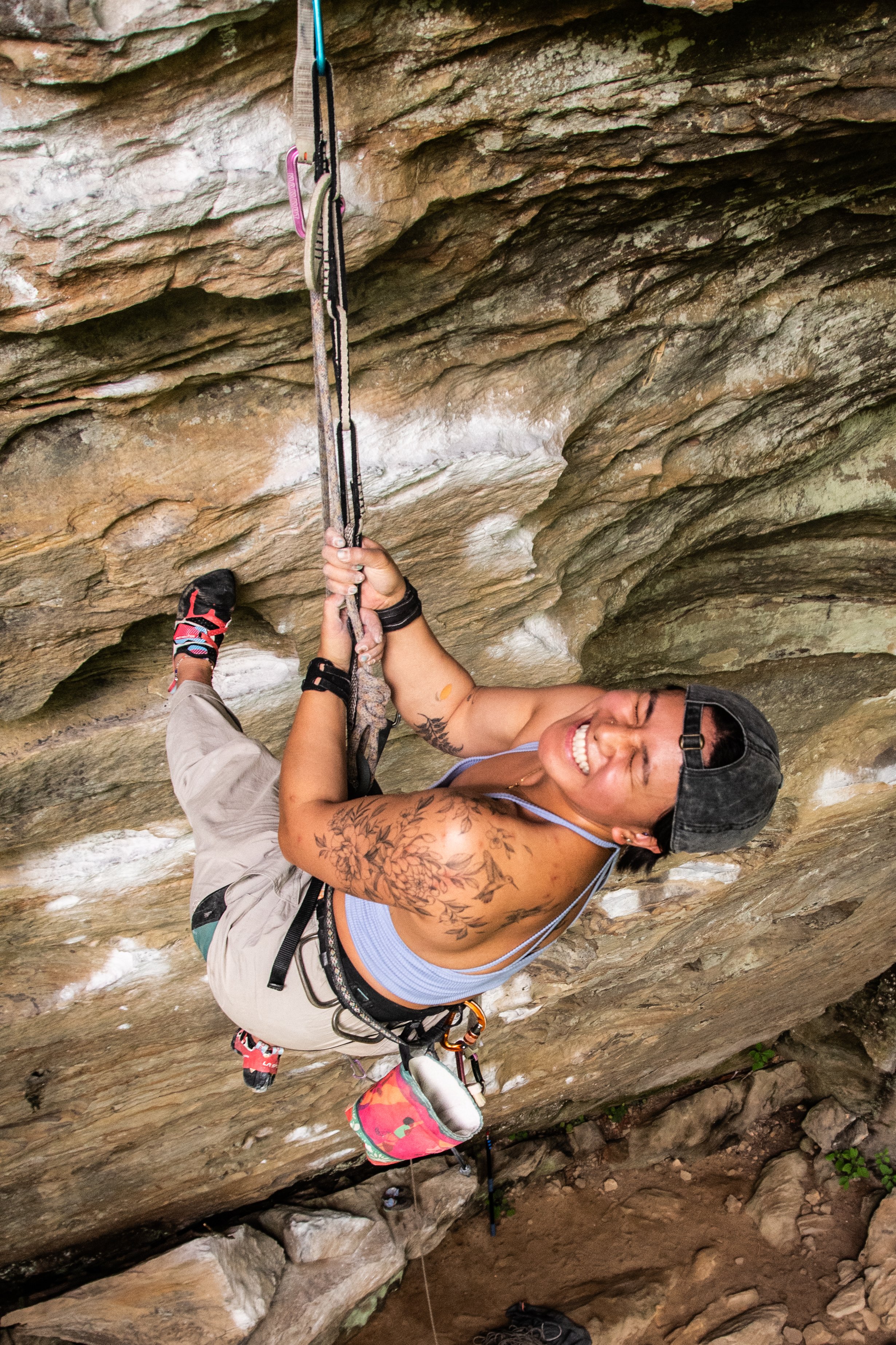
Meetups are not guided or instructional in nature. They are opportunities for participants to meet each other and find new friends to climb with. Meetup leaders will be familiar with local climbing. We encourage all participants and meetup leaders to make informed risk decisions and have conversations about risk and experience with all new climbing partners. Remember, climbing is inherently dangerous and you are responsible for your own safety.
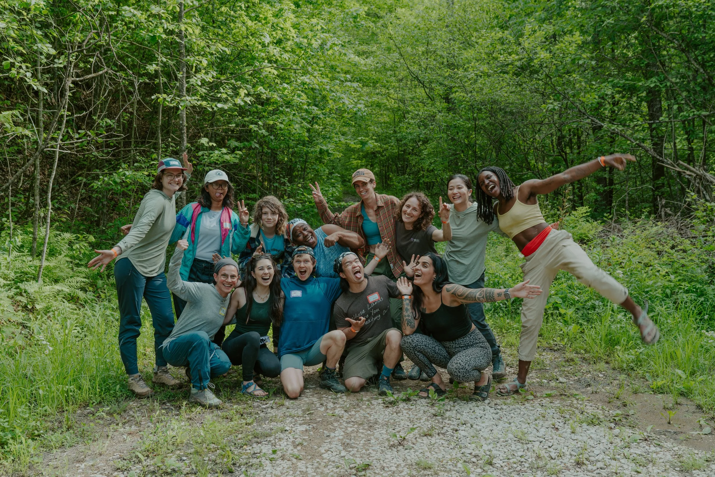
who’s meeting?
Literally everyone at Mini Fest ;)
Come to the Lago Linda Hideaway Pavilion at 10am on Friday to find your climbing crew! Climber Coffee will start at 9am :)
Saturday meetups will meet after the group photo at 10:30am on Saturday.
Along with Meetup groups, we’ll also help facilitate finding climbing partners who share your goals for the weekend!
Friday Meetup
Overhangs are hard, and everywhere... Come seek out all the anti RRG style routes and climb techy vert and slabby routes instead! It's sexy ;)
Slab is Sexy

Friday Meetup
with Femmes & Thems
Femmes and Thems is a growing, transgender and femme affinity group that convenes monthly in Chicago! Whether you are a seasoned climber or first time on the wall, our group provides a space to connect climbers at all levels. Come join us for a chill, low pressure ropes sesh with some arts and crafts on the side! This session is about climbing together and creating together. Hope to see you there!
Arts, Crafts and CRUSH
Saturday Meetup
with Queer Climbers of Fort Wayne
Queer Climbers of Fort Wayne is an inclusive, empowering community of LGBTQIA+ climbers and allies across all experience levels based in Fort Wayne, Indiana. We'll be putting up lead and top rope routes for foxy folks to climb, socialize, and just enjoy being with a bunch of trans and nonbinary people in nature! This meetup is open to transgender and nonbinary climbers, and allies!
Trans Folks on Ropes
Climbing Areas
-
Google Maps: Ash Branch Climbing
Ash Branch is a privately-owned crag near Muir Valley. This area gets morning sun to full shade. Some of these routes are still cleaning up, so expect some choss. Helmets are recommended.
Approach + Trail Surface: From the parking area, find the green rules sign and hike downhill on the wide gravel path. Cross the creek and head uphill, turning left at the arrow. Trail reaches the cliff to the right of Humanoid. Go left for Humanoid- routes are still listed left to right.
Directions: From Lago Linda, get onto KY-11 and drive toward Mountain Parkway for 5.8mi. Take a slight right onto KY-715. Continue for 2.6mi then take a right onto Big Andy Ridge Rd (JCT 2016). After .8mi take a left onto Fincastle Rd. Look for a gravel drive on the right with a wooden sign that says ‘Ash Branch Climbing’ approx .2mi after turning onto Fincastle Rd. Descend the steep hill from there, taking a hard left at the bottom to find parking.
Do not climb tagged routes. These routes are undergoing cleaning, not complete, or not open to the public. -
Google Maps: Motherlode Parking Lot
Bald Rock Recreational Preserve (BRRP) is owned by the Red River Gorge Climbers’ Coalition and home to the Red’s iconic Motherlode. This area also hosts other popular areas like the Chocolate Factory and Hazel Hollow. You’ll find a host of climbs ranging from 5.6 to 5.14d here.
Approach + Trail Surface: Trails vary based on destination, ranging from short and flat to uneven. Trails between climbing areas are mixed terrain including exposed rocks, loose sand/dirt, and mud. Please use Mountain Project or a guidebook to gauge the trail to your specific destination.
Directions: From Lago Linda, turn right onto KY-52 E. Continue for 2.4mi and turn left onto HWY 498. After 1 mile turn left onto Bald Rock Fork Rd, which will be a gravel road on your left. From KY-11, turn right onto Hwy 498. After 1mi, you can take a slight right toward Hopewell Church or continue on Hwy 498, round a corner, and turn right onto Bald Rock Fork Rd (gravel road).
All cars will enter the area via a steep hill. There are three parking lots at the base of the Motherlode hill. There is a top lot on the left side before you enter the steep hill, recommended for 2WD cars. -
Google Maps: CFRP Main Parking Lot
Cave Fork Recreational Preserve is part of the Red River Gorge Climbers’ Coalition’s most recent land acquisition - the largest land purchase in climbing history - and home to popular crags: Hatchett Wall, Zun’s Wall, and The Venue. Helmets are highly recommended when climbing here as routes are still cleaning up as public traffic increases.
Approach + Trail Surface: Trails vary based on destination, ranging from short and flat to uneven. Trails between climbing areas are mixed terrain including exposed rocks, loose sand/dirt, and mud. Please use Mountain Project or a guidebook to gauge the trail to your specific destination.
Directions: From Lago Linda, get onto KY-11 and head North toward Mountain Parkway. Continue for 5.4mi. Turn off highway 11 onto Ashland Camp Loop and then onto the dirt/gravel Cave Fork Road. Wind down a hill for about a half mile crossing a small stream at the bottom of the hill. Turn left on the dirt road and continue for another half mile crossing a second, more technical stream (depending on recent wetness) before reaching the large gravel lot on your left. 4WD is helpful but not required.
Do not block oil machinery.
-
Google Maps: Cliffview Recreational Preserve
Cliffview Recreational Preserve is owned by Cliffview Resort and Lodge and managed by the Red River Gorge Climbers’ Coalition. This newly developed area hosts climbs ranging from 5.6 to 5.13-.
Crags in this area are still being developed so please respect red tags and stay on trails. Helmets are highly recommended when climbing here as routes are still cleaning up as public traffic increases.
Approach + Trail Surface: Trails vary based on destination. Trails between climbing areas are mixed terrain including exposed rocks, loose sand/dirt, and mud. The North trail includes a significantly steep wood staircase. Please use Mountain Project or a guidebook to gauge the trail to your specific destination.
Directions: From Lago Linda, get onto KY-11 and drive toward Mountain Parkway for 5.8mi. Take a slight right onto KY-715. Cable Ridge Road is located along KY 715 about 0.5 miles NE of the intersection with KY 11. From Cable Ridge Rd it is 0.5 miles to the gate. Go 200 yards (1/8 mile) past the gate to the 2nd road on the left. Turn left here and continue 0.4 miles to the 3 way fork where you'll see signage for the climbing access. Take the middle fork and follow the signs to the parking lots.
-
Google Maps: Graining Fork Nature Preserve
Graining Fork Nature Preserve (Roadside) is a privately owned and operated crag. Permits are required for access and must be requested in advance. Popular routes include Roadside Attraction, Return of Chris Snyder, and Ro Shampo.
Approach + Trail Surface: Park in the gravel lot shared with Hop’s Fork Restaurant and cross the road. Follow the trail to the cliffline.
Directions: From Lago Linda, get onto KY-11N and drive toward Mountain Parkway. Park in the lot shared with Hop’s Fork.
This climbing area is access-friendly to 2WD vehicles.
Permits: Permit requests are reviewed and issued every week on Monday. Instructions for requesting permits are on the GFNP website.
-
Google Maps: Miller Fork Recreational Preserve
Miller Fork Recreational Preserve (MFRP) is owned by the Red River Gorge Climbers’ Coalition and home to popular areas like the Infirmary, Fruit Wall, and Camelot.
Approach + Trail Surface: Trails vary based on destination. Trails between climbing areas are mixed terrain including exposed rocks, loose sand/dirt, and mud. Please use Mountain Project or a guidebook to gauge the trail to your specific destination.
Directions: 4WD/AWD highly recommended for access. River crossing required if approaching from Beattyville and navigated via Holly Rd.
From Lago Linda, get onto KY-11 N towards Mountain Parkway. Continue for approx 5mi and turn right onto Shoemaker Rd. Continue on Shoemaker Rd for 3.5mi. You’ll pass a house with a lot of equipment in the yard, a 35mph speed limit sign, and possibly pigs (beware, they’re free roaming). Be prepared to take the middle driveway once you round the corner; the descent is steep at first.Do not block oil machinery. Please do not park on Shoemaker Rd.
-
Google Maps: Muir Valley Nature Preserve
Muir Valley Nature Preserve is operated by the Friends of Muir Valley and hosts the highest concentration of climbs in the 5.2-5.10a range. Climbing access to this area costs $15 per car.
Approach + Trail Surface: Trails vary based on destination. Trails between climbing areas are mixed terrain including exposed rocks, loose sand/dirt, and mud. The North trail includes a significantly steep wood staircase. Please use Mountain Project or a guidebook to gauge the trail to your specific destination.
Directions: From Lago Linda, get onto KY-11 and drive toward Mountain Parkway for 5.8mi. Take a slight right onto KY-715. Continue for 2.6mi then take a right onto Big Andy Ridge Rd (JCT 2016). After .8mi take a left onto Fincastle Rd.
This climbing area is access-friendly to 2WD vehicles.
-
Google Maps: Motherlode Parking Lot
Pendergrass-Murray Recreational Preserve (Motherlode entrance) is owned by the Red River Gorge Climbers’ Coalition and home to some of the Red’s most popular areas like Drive-By, The Gallery, and Purgatory. You’ll find a host of climbs ranging from 5.6 to 5.14d here.
Approach + Trail Surface: Trails vary based on destination, ranging from short and flat to uneven. Trails between climbing areas are mixed terrain including exposed rocks, loose sand/dirt, and mud. Please use Mountain Project or a guidebook to gauge the trail to your specific destination.
Directions: From Lago Linda, turn right onto KY-52 E. Continue for 2.4mi and turn left onto HWY 498. After 1 mile turn left onto Bald Rock Fork Rd, which will be a gravel road on your left. From KY-11, turn right onto Hwy 498. After 1mi, you can take a slight right toward Hopewell Church or continue on Hwy 498, round a corner, and turn right onto Bald Rock Fork Rd (gravel road).
There are multiple parking areas depending on which crag you are going to. All cars will enter the area via a steep hill. Once at the base of hill, continue down the road to the parking lot for your crag. There is a top lot on the left side before you enter the steep hill, recommended for 2WD cars.Do not block oil machinery.
Parking lots:
Flat Holler Parking Lot Crags: Velo, Throwback, The Lumber Yard, The Getaway, The Shipyard
Sore Heel Hollow Parking Lot Crags: Curbside, The Gallery, Left Field, Volunteer Wall, The Playground, Bronaugh, The Mega Cave, North 40, Purgatory, Courtesy, Rival, Shady Grove, The Shire, What About Bob
Drive-By Parking Lot Crags: Drive-By, Chica Bonita, Bob Marley
Note: Sore Heel Parking Lot is only recommended for 4WD/AWD cars with substantial clearance. There is an access trail off of the main road to hike back to these crags. -
Google Maps: Far Side Parking Lot
Pendergrass-Murray Recreational Preserve (Coal Bank entrance) is owned by the Red River Gorge Climbers’ Coalition and home to some of the Red’s most popular areas like Darkside, Solar Collector, and Gold Coast. You’ll find a host of climbs ranging from 5.6 to 5.14d here. Gold Coast also has some great entry-level trad for you crack climbers.
Approach + Trail Surface: Trails vary based on destination, ranging from short and flat to uneven. Trails between climbing areas are mixed terrain including exposed rocks, loose sand/dirt, and mud. Please use Mountain Project or a guidebook to gauge the trail to your specific destination.
Directions: From Lago Linda, get onto KY-11 and head North toward Mountain Parkway. Continue for 5.4mi. Once you pass the Marathon gas station, prepare to turn left in about a mile onto Hwy 1036 toward Peaceful Valley Resort. This road will change from pavement to gravel. Continue on this road for approx 5mi. When you see a black tank on the left side of the road, turn right onto the next gravel road.
It is recommended to approach via Fixer Rd, not Cave Fork via Ashland Camp Rd. There is a central parking area for all crags. 4WD/AWD highly recommended for access.Do not block oil machinery.
-
Google Maps:
Beer Trailer Parking
Emerald City and Global Village ParkingThroughout the Southern Gorge there are pull-offs along KY-11 for popular climbing areas such as Beer Trailer, Global Village, and Emerald City.
Approach + Trail Surface: Trails vary based on destination, ranging from short and flat to uneven. Trails between climbing areas are mixed terrain including exposed rocks, loose sand/dirt, and mud. Please use Mountain Project or a guidebook to gauge the trail to your specific destination.
Directions: From Lago Linda, get onto KY-11 and drive toward Mountain Parkway.
-
Google Maps:
Nada Tunnel Access
Sky Bridge Rd AccessThe Northern RRG hosts the majority of the Red’s trad climbing, but also some classic sport. This is where you’ll also find the Red’s first classified rock climb, Caver’s Route, and the uber classic Bedtime for Bonzo 2-pitch romp. Climbing is within the Daniel Boone National Forest and managed by the US Forest Service.
Approach + Trail Surface: Trails vary based on destination. Trails between climbing areas are mixed terrain including exposed rocks, loose sand/dirt, and mud. Please use Mountain Project or a guidebook to gauge the trail to your specific destination.
Directions: There are two ways to enter the DBNF Scenic Loop which is the main access road for the majority of crags in the North. From Lago Linda, get onto KY-11 and drive toward Mountain Parkway. If you are entering via Nada Tunnel, pass under Mountain parkway and turn left onto KY-15N. After 2.2mi, turn right onto KY-77N. Note: Nada Tunnel can only accommodate cars in one direction at a time. You may have to wait as cars pass through. To enter via Skybridge Rd, take a slight right onto KY-715 as if you are going to Muir Valley. Continue for 18mi and take a right onto Sky Bridge Rd.
Parking spots are pull-offs from the main road, paved and 2WD friendly.