
LODGING + LOCAL BETA
Flash Foxy Climbing Festival • BISHOP • March 13-15, 2026
The Flash Foxy Climbing Festival will take place in and around the town of Bishop, CA in the Eastern Sierra Mountains. Bishop is located within the lands traditionally known as Payahuunadu, which is the traditional ancestral homeland of the Nuumu and Newe. Learn more about the Bishop Paiute Tribe.
Getting Here
Small Town... With a Big Backyard
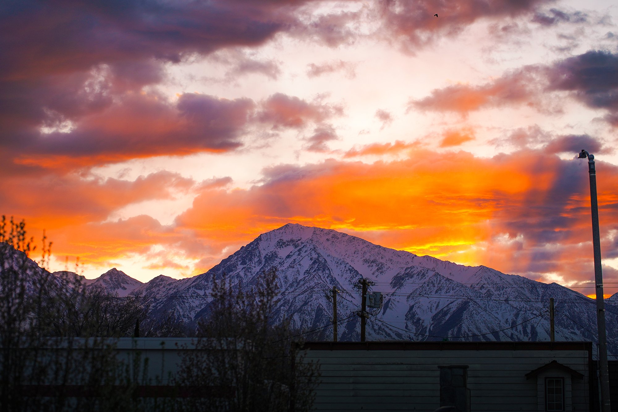
The City of Bishop is a small city in the spectacular Eastern Sierra region of California. The Eastern Sierra region is about the middle of the state along its eastern border with Nevada and about halfway between Yosemite and Death Valley National Parks.
Nearest Cities? Closest Airports?
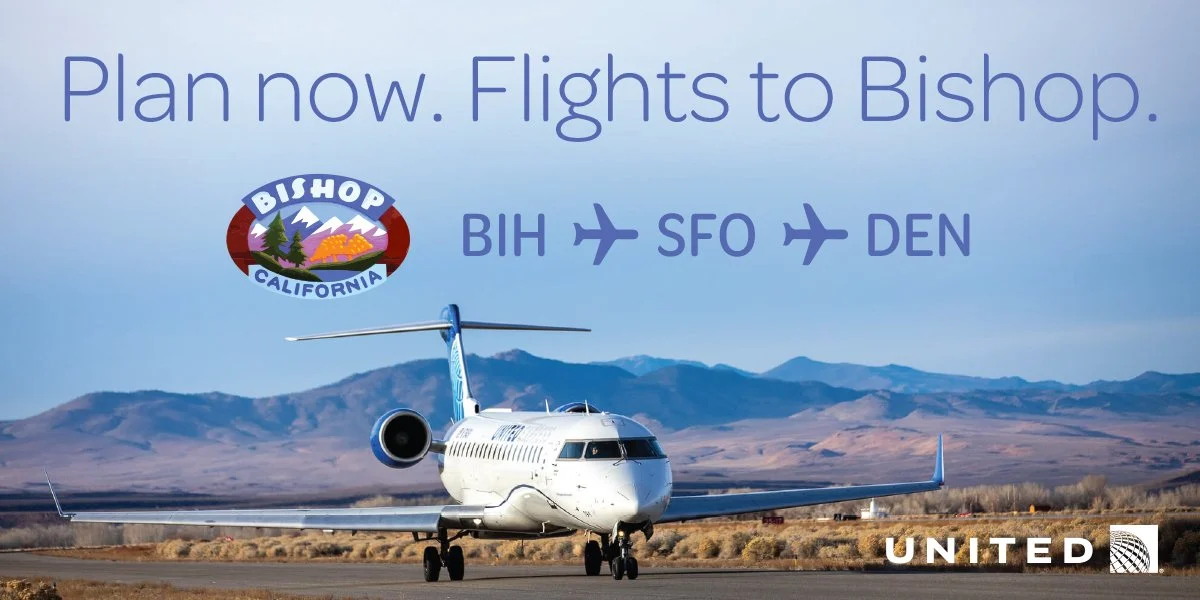
There are a few options. You can now fly directly into Bishop! Flights into Bishop run on a limited schedule and we cannot guarantee that flights will be available during our festival weekend.
You can fly into any airport in the Los Angeles area (LAX, Burbank, Long Beach, Orange County, Ontario), San Diego, Reno, Las Vegas or the Bay Area (SFO, Oakland, San Jose). You’d have to rent a car or carpool from any of these places. It’s about a 5-6 hours drive from all these airports except Reno (which is 3.5 hours).
There is a daily shuttle that runs from Reno to Bishop. Find our more here.
Share rides + Lodging!
We have created a Discord Group where registered participants can coordinate carpools, ride shares and travel plans with one another. Registered participants will receive a link to the spreadsheet with their ticket confirmation (it’s in the linktree!). If you can’t find the link email events@flashfoxy.com !
Stay with us!
*Flash Foxy is not responsible for participant lodging. Flash Foxy is not able to assist with booking.

camping @ Tri-county fairgrounds
Want our recommendation? Set up camp at the Tri-County Fairgrounds and you can be first to breakfast + first to bed even if you stay ‘til the end of programming! Our Friday Opening Party and all Saturday programming will be held at the Fairgrounds.
While tent camping isn’t typically available at the Fairgrounds, you can CALL 760-873-3580 to reserve your festival tent site. Just let them know you’re coming for Flash Foxy! If you are having trouble reaching them by phone, you can email michelle@tricountyfair.com.
Sites are $25 per tent/night. Car/van camping is permitted at $25 per vehicle/night. Showers, bathrooms, and potable water are available. They also have electricity, gated parking, and a camp host for security. You must check-in and pay at the Office upon arrival.
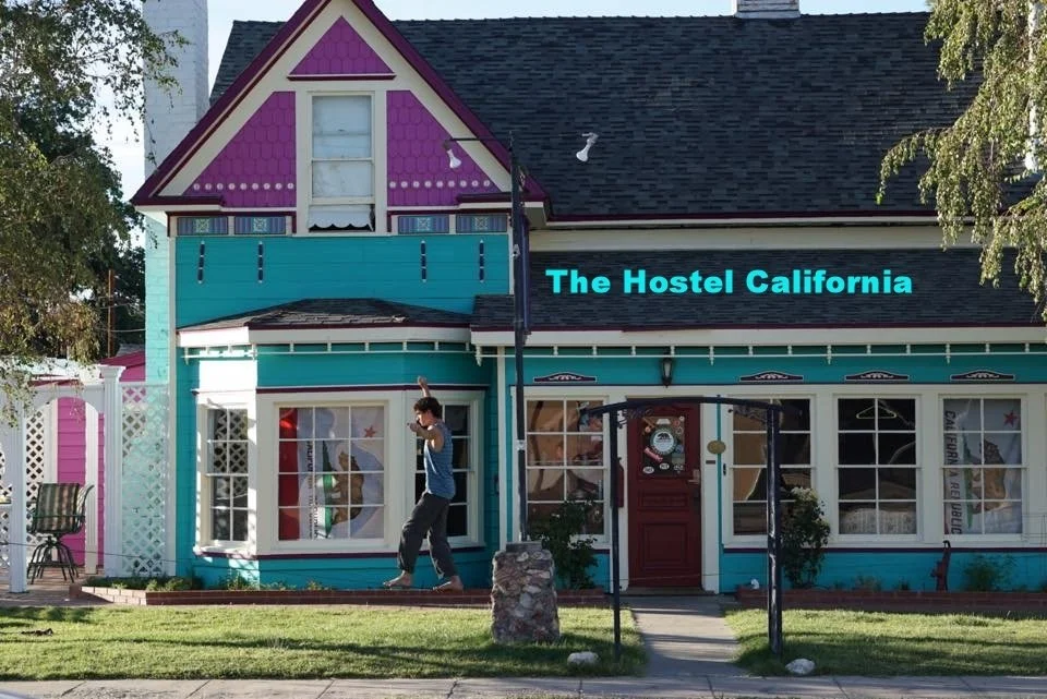
The Hostel California
We’re partnering with our favorite local community-owned hostel once again to give you the Flash Foxy filled weekend of your dreams! If you prefer to sleep inside, we’d recommend staying at THC! The entire hostel is reserved for Flash Foxy participants for the weekend!
Private Rooms: $80-130 per night, plus tax
Dorm Beds: $30 per night, night
The hostel tends sell out pretty quickly for the festival weekend. To book YOU MUST CALL 760-399-6316 and let them know you’re coming to town for Flash Foxy!
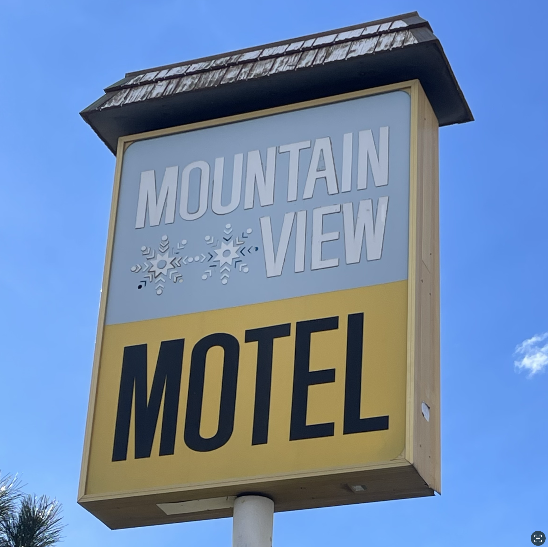
Mountain View Motel
A special discount for festival participants! Get 20% OFF your stay at Mountain View Motel!
To receive your Flash Foxy discount, YOU MUST CALL (760) 873-4242 and let their wonderful front desk person, Maria, know you’re coming for Flash Foxy!
Prefer Privacy?
*Flash Foxy is not responsible for participant lodging. Flash Foxy is not able to assist with booking.
HOtels
Click here for more local lodging options!
CAMPING
For those of you who like taking drives through the desert at night, there are a number of camping options available just outside town.
The most well-known and popular campground is the Pit on BLM land costs $5/night per vehicle and has bathroom facilities.
There also is the Pleasant Valley Campground for $14/night per vehicle.
You can also check out the US Forest Service campgrounds in and surrounding Bishop.
LOCAL BETA
A few of our fav local businesses and hangout spots! Check them out while you’re in town!
Food + Coffee
Looney Bean - our coffee sponsor <3 plus super tasty lunch food!
Blacksheep Coffee Roasters - the climber coffee shop (& to-go burritos)
Pupfish Cafe - fresh made-to-order food (& coffee)
Great Basin Bakery - to-go baked goods and sandwiches (they have lemonade)
Crearee - Mexican food to-go
Manor Market - groceries, snacks, and to-go food!
Rolling Chef - Latin fusion food truck
Las Palmas - Mexican food
Food Truck Lot - we can’t guarantee what will be open, but there might be really good tacos, Vietnamese food, and more!
Indy Coffee Roasting - if you miss our breakfast on Sunday stop by their weekly “Queer Coffee Church” Pop-up coffee shop!
SHOPPING
Sage to Summit - gear shop & indoor climbing gym!
Eastside Sports - gear shop
Mammoth Gear Exchange - used gear outfitter
The Toggery - get yourself an outfit for our Rhinestone Disco Cowboy Opening Party!!!
Spellbinder Books - before phones, people read paper books
C5 Community Arts - Community arts center
Elevated - local gift shop featuring fab Smokey the Bear swag
Activities
For when you need a break from climbing, or for that non-climber who came with you <3
Owens Valley Paiute-Shoshone Cultural Center - learn about the history and peoples of Payahuunadu (and make a donation to the tribe)
Keough’s Hot Springs - soothe sore muscles in a vintage hot pool
Bishop Twin Theater - they have hot dogs
Back Alley Bowl & Grill - bowling anyone???

Climbing Areas
FREE access to KAYA Digital Guidebook! Fill out this link by March 12th!!
-
Google Maps: Happy Boulders
The Happy Boulders has climbs of all shapes and sizes on friendly volcanic rock. This is a great place for newer boulderers to explore Bishop climbing!
Approach + Trail Surface: moderate-steep uphill 0.5-1.0 miles on soft sand. Trails between climbing areas are mixed terrain including low flat boulders, packed sand and soft sand.
Directions: The Happy Boulders can be accessed by two different routes out of Bishop. From Main Street (395) you can take the junction for Highway 6. Then turn left onto Five Bridges Road and continue until you reach the intersection at which you will turn left onto Chalk Bluff road. Continue down Chalk Bluff road for 2.3 miles until you reach the Happy Boulder parking. From Main Street (395) continue north out of Bishop as if you were driving to Mammoth. Turn Right onto Pleasant Valley Dam Road and continue on it until you get past the County campground. Turn right onto Chalk Bluff road and continue for about 3.6 miles until you reach the Happy Boulders parking area.
-
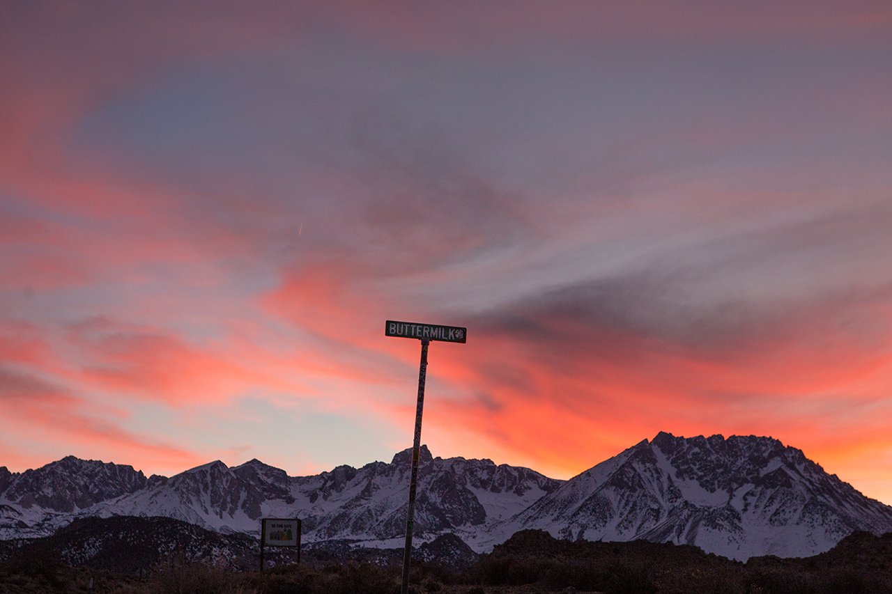
Google Maps: Buttermilks
The Buttermilks hosts iconic boulders beneath large beautiful mountains. The rock is sharp, the landings are flat, and the boulders tend to be pretty tall. This area is best for folks with a bit more bouldering experience.
Approach + Trail Surface: mild-moderate uphill 0.25-0.5 miles on packed dirt/sand/gravel mix. Trails between boulders are packed dirt/sand/gravel mix
Directions: Turn off State Route 168 about 7 miles west of Bishop onto Buttermilk Road. There is parking available along the roadside. The Department of Water and Power land is closed to camping. Inquire at the White Mountain Ranger Station for camping information and a map. DRIVE SLOW on Buttermilk Road, it has been known to crack oil pans of low clearance speeding vehicles
-
Google Maps:Owens River Gorge
The Owens River Gorge has sport climbs on volcanic tuff that shines in the 5.10 and up grades, although there are also ample options in the lower-grade ranges. The approach can be arduous and steep, and often includes river crossings. The central and upper gorge are better suited to intermediate/advanced climbers. The lower gorge has better options for newer climbers.
Approach + Trail Surface: mild-steep terrain 0.5-1.0 miles. Length and difficulty of approaches vary. Trail surfaces include: packed dirt roads, large steep gravel stairs, scrambling over large boulders on steep terrain and crossing rivers using logs as bridges.
Directions: From Bishop go North on 395 to the Paradise Swall Meadows exit and turn right. Go approximately 1/2 mile and at the T intersection turn left (Gorge Rd). There are 3 parking areas to choose depending on where in the Gorge you wish to climb. The first parking area is 3.3 miles from the intersection of Gorge road and 395. Adjacent to the parking area you will go through a gate and follow the paved central gorge power station road for 1 mile down to the Central gorge power station. The second parking area also accesses the central gorge and ends just uphill from the central gorge power station. You will find a trail adjacent to the parking area that goes down a steep 2nd/3rd class loose gully. Be careful not to dislodge anything because there are climbs below the gully. This parking area is 4.8 miles up the Gorge road from the intersection of Gorge Road and 395. The last parking area is for the upper gorge. This parking area is 6.4 miles up Gorge Road from the intersection of Gorge Road and 395. You will park off the pavement and walk through a gate down the paved upper power plant road approximately 1/2 mile then drop into a 3rd class gully. There is a trail along the entire length of the bottom of the gorge so you can use any of the access points to access all climbs at Owens.
-
Google Maps: Alabama Hills
The Alabama Hills sits beneath Mount Whitney and hosts gorgeous views of the Eastern Sierra. You’ll find sport bolted granite climbing on beautiful, brown patina with minimal approaches. This area is excellent for beginner and intermediate climbers!
Approach + Trail Surface: many areas can be approached within 100ft of parking. Some areas may have longer approaches and may depend on road conditions. Trail surface is packed dirt/sand with occasional scrambling to access specific climbs.
Directions: Take Whitney Portal Road off US 395 to this area. Most of the climbing is accessed from Movie Road, which heads north from the Whitney Portal Road.
Venues
+ Accessibility
-
All primary festival event venues (opening party, open air market, film screenings, panels) will be held at wheelchair accessible venues and will have accessible bathrooms. The Opening Party and Foxy Fair take place outside in a flat grassy field with paved paths. Film screenings, panel, dinner and other activities will take place in the Heritage Arts Building at the Tri-County Fairgrounds - this building is ground-level. The Community Slideshow will take place at Mountain Rambler Brewery - this building is ground-level. Seating will be available during all events.
All films will have captions in English. ASL interpreters can be coordinated upon request. Please email events@flashfoxy.com to discuss your needs.
Approaches differ by climbing area. Details about approaches can be found below, or can be found on Mountain Project.
Have an accessibility concern? Reach out to events@flashfoxy.com and we’ll see how we can help!
We are always working to make the Flash Foxy Climbing Festival a more inclusive and welcoming space, please let us know what we can do to make our event more accessible for you. Unfortunately, we are not always able to arrange accommodations, but we will do our best and will provide honest answers about the our event spaces, staff capabilities and the activities that take place at our festivals. Thank you for learning and growing with us!
-
Google Maps: Tri-County Fairgrounds
About the venue: All of our Saturday programming, with the exception of clinics, and our Sunday morning programming will take place at the Eastern Sierra Tri-County Fairgrounds. The Open Air Market and Workshops will take place in a grassy field, other outdoor programming takes place in parking lots. Film screenings, panel, dinner and other activities will take place in the Heritage Arts Building - this building is ground-level and has accessible bathrooms.
Directions: Turn west on to Sierra Street from US 395 in Downtown Bishop, drive 2 blocks and turn right into the Fairgrounds under the front gate arch. There is a large parking lot with marked accessible parking spaces available.
-
Google Maps: Eastside Student Center
About the venue: Friday Climber Coffee will take place at The Eastside Student Center. This building is ground-level. Bathroom is not wheelchair accessible. Eastside Student Center is about 1 mile away from the Tri-County Fairgrounds.
Directions: Eastside is located on W Line St, just past the traffic light.. The entrance is on W Line St., facing the sidewalk.
Parking: There are multiple parking lots and street parking.
-
Google Maps: Owens Valley Paiute-Shoshone Cultural Center
About the venue: All Sunday morning programming will take place at The Owens Valley Paiute-Shoshone Cultural Center. This building is wheelchair accessible with wheelchair accessible bathrooms. Programming will take place indoors with outdoor space available. The Cultural Center is 1.7 miles away from the Tri-County Fairgrounds.
Directions: The Cultural Center is located on W Line St. about a mile outside of town. It will be located on the right hand side of the road as you’re headed to the Buttermilks.
Parking: Accessible parking is available in the parking lot.
-
Google Maps: Mountain Rambler Brewery
About the venue: Friday Climber Coffee and our Sunday Community Slideshow will take place at Mountain Rambler Brewery. This building is ground-level and has accessible bathrooms. The venue is often dark, loud, and crowded. Seating is available both indoors and outdoors.
Directions: Located on Main Street near the traffic light at the intersection of E/W Line Street. The brewery is located in a small parking lot which can be accessed via Short Street.
Parking: Accessible parking is available in the parking lot. All other Flash Foxy participants should use street parking. The parking lot is very small and needs to be shared with local patrons of all businesses in the parking lot. Thank you for your cooperation!
EVENT PERMITS
-
In accordance with Federal law and U.S. Department of Agriculture (USDA) civil rights regulations and policies, this institution is prohibited from discriminating on the basis of race, color, national origin, sex, age, disability, and reprisal or retaliation for prior civil rights activity. (Not all prohibited bases apply to all programs.) Persons with disabilities who require alternative means of communication for program information (e.g., Braille, large print, audiotape, American Sign Language, etc.) should contact the responsible State or local Agency that administers the program or USDA’s TARGET Center at (202) 720-2600 (voice and TTY) or contact USDA through the Federal Relay Service at (800) 877-8339. Additionally, program information is also available in languages other than English.
To file a complaint alleging discrimination, complete the USDA Program Discrimination Complaint Form, AD-3027, found online at http://www.ascr.usda.gov/complaint_filing_cust.html, or at any USDA office or write a letter addressed to USDA and provided in the letter all of the information requested in the form. To request a copy of the complaint form, call (866) 632-9992. Submit your completed form or letter to USDA by: (a) mail: U.S. Department of Agriculture Office of the Assistant Secretary for Civil Rights, 1400 Independence Avenue, SW, Washington, D.C. 20250-9410; (b) fax: (202) 690-7442; or (c) email: program.intake@usda.gov.
USDA is an equal opportunity provider, employer, and lender.